The Anaga Mountains feel like a different island from Tenerife’s southern resorts. Jagged ridges rise above deep ravines, roads curl through humid laurel forest and small communities occupy slopes that appear almost impossibly steep.
Anaga rewards curiosity, but it also demands realistic planning. Distances are short on a map while journeys can be slow, parking limited and weather markedly different from the coast.
This article is part of our Tenerife series. Listen to Tenerife beyond the resorts with writer John Reid for more local stories and practical ideas.
Begin at Cruz del Carmen
Cruz del Carmen is the most useful introduction to Anaga. Its visitor centre provides context for the landscape, and nearby paths allow visitors to experience laurel forest without immediately committing to a demanding hike.
The forest survives in moisture carried by the trade winds. Laurels, heathers and other evergreen species create a landscape that can be cool and misty even when Santa Cruz is sunny.
Choose a walk that matches your ability
Anaga contains everything from short woodland paths to strenuous routes with considerable ascent and descent. Do not select a walk purely from attractive photographs.
Tenerife ON uses the MIDE system, which considers route conditions, navigation, technical difficulty and physical effort. Check the official route listing, closure notices and weather before starting. Some protected areas require reservations or impose access controls.
Stop at the viewpoints—but park responsibly
Pico del Inglés and other signed viewpoints reveal Anaga’s folded ridges and, in clear weather, views towards the coast and neighbouring parts of Tenerife. The roads are narrow, so use designated spaces and never stop where you obstruct traffic.
Descend towards Taganana
Taganana is one of Anaga’s best-known villages, surrounded by terraced slopes and dramatic peaks. It makes a good lunch stop and a base for understanding how communities adapted to a remote agricultural landscape.
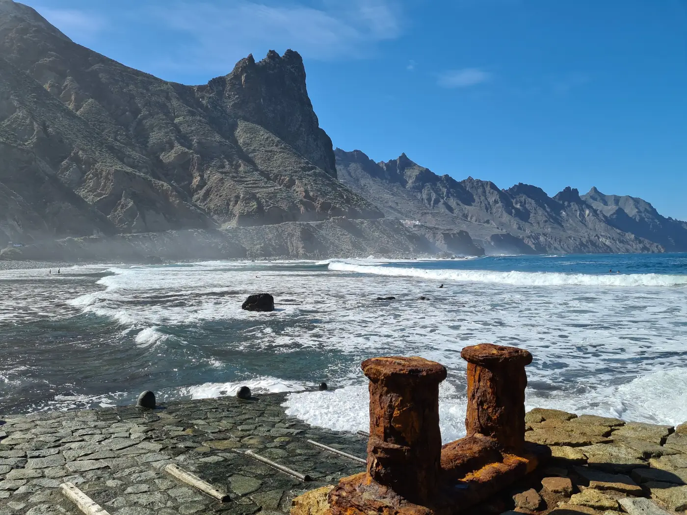
Continue towards the Atlantic only if time and road conditions allow. Roque de Las Bodegas offers a powerful view of the cliffs and ocean, but the sea can be rough and access conditions can change.
Look beyond the headline villages
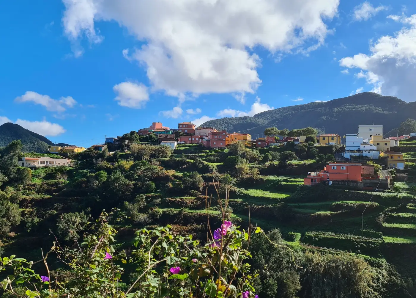
Chinamada is known for traditional cave houses, while Las Carboneras occupies a green valley landscape of terraces and scattered homes. These are living communities rather than open-air attractions: drive carefully, respect private property and support local businesses where possible.
Public transport can be an advantage
A car offers flexibility, but it is not automatically the easiest option. Parking at popular trailheads is limited, and the driver misses much of the scenery. TITSA buses serve parts of Anaga, including routes connecting La Laguna with Las Mercedes and recreational areas such as Llano de Los Viejos.
Check current timetables carefully and build in generous margins. Services to smaller communities may be infrequent.
What to bring
- Water and food appropriate to the length of your route.
- Footwear with dependable grip.
- A light waterproof layer, even when the coast is clear.
- Sun protection for exposed ridges and coastal sections.
- An offline map or downloaded route information.
- A charged phone, while recognising that coverage may vary.
A sensible first-day route
For a first visit by car, travel from La Laguna to Cruz del Carmen, take a short forest walk, stop at one or two designated viewpoints and then decide whether conditions justify continuing towards Taganana. Avoid trying to combine every village, beach and trail in a single day.
Anaga’s appeal comes from contrast: forest and ocean, mist and sunlight, isolation and living rural culture. Give it time rather than turning it into a race between pins on a map.
Before travelling, consult the official Tenerife ON route planner and closure notices.